Death Valley Flowers and Mines
The trip to Death Valley was to see the flowers and drive up canyons to see mines. As you can see from the thumbnail pictures above, the trip was a success. The date of the trip was Feb 24 to 26, 2016. The weather was clear temperature about 80 F and was perfect. We drove up three canyons (Trail, Titus, and Warm Springs canyon) and to the Eclipse mine on the third day on the way home. The first night we stayed in Beatty, NV and the second night in Pahrump, NV. A second trip was made March 15 to 17 where we camped on the Trail Canyon road.
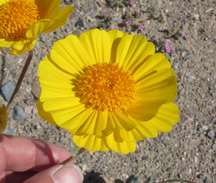
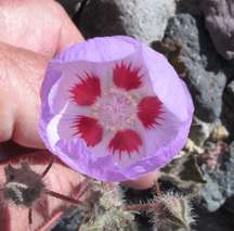
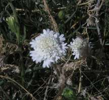
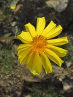
Flowers We had been hearing that the flowers were quite good in Death Valley, and since we hadn't been seeing much signs of blooms elsewhere in our desert travels it was decided that we must go enjoy them. There were a lot of sunflowers and evening primrose in the middle of the Valley where North Hwy 190 and the Daylight Pass road crossed. From a distance it gave a thin yellow wash to the colorful hillsides. Our second day in the Valley took us to the southern reaches of the park. The flowers were more concentrated there and had more variety. Among the flowers we found were the (predominant) sunflower, the pale evening primrose, purple Phacelia, pink Sand Verbena and Desert Five Spot. In certain washes we found yellow SunCups predominating. More rare finds were the tiny Broad leafed Gilia, Nama, tiny white Crypantha and some monkey flower. All in all a good show for Death Valley with it's spectacular geology as a backdrop. To see the pictures of the flowers click here for the link.
Trail Canyon Trail canyon is on the west side of the valley and is accessed off the West side road. The road up the alluvial fan is good, but when the road enters the canyon it becomes rocky and slow. At 9.9 miles the mining camp ends the road. Lots of building remain and a long trailer is perched on the side of a hill. Early mining was for gold and started in 1906. Antimony and Tungsten were mined later with the mining stopping about 1950. There are other sites we did not visit, but will in the future. Here are the pictures for the canyon. The national park has a report of the canyon and can be read here.
Trail Canyon South Fork and side canyon hike We Drove up the main canyon and at 9.7 miles a road turns off to the left up the south fork. We parked about 0.4 miles up the canyon and hike the rest of the way to the mine camp. The mine was further up the hill. These pictures can be seen here. The camp has several buildings and are well preserved. We also went on a hike about 5 miles from the West side road and saw a herd of Desert Mountain Sheep. The Pictures are here.
Titus Canyon Titus Canyon is a one way road starting 6 miles west of Beatty on Highway 374 (Beatty to Death valley) and twisting and turning for 26 miles. The road surface is good (all the exploring was done in a 2016 Toyota 4Runner) but the road is narrow and winds down steep sides of mountains. An old mine(Leadville) remains at the middle of the trip. The geology of the uplifts and fold are exposed and most are next to the road. Pictures can be seen here.
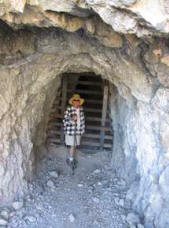
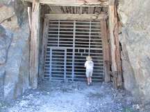
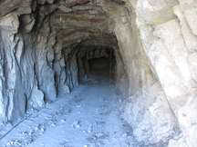
Warm Springs camp and mines The good Warm spring road is off the southern end of the West Side road. Several talc mines at 10 miles can be visited and information about the mines can be read here. Two miles further up the road at 12 miles, the Warm springs camp has several well preserved buildings, a swimming pool, and old mining equipment. Information about the camp can be read here. Pictures can be seen here.
Eclipse Mine The Eclipse mine is on the west side of highway 127 14 miles south of Shoshone. This is a talc mine. Pictures can be seen here.