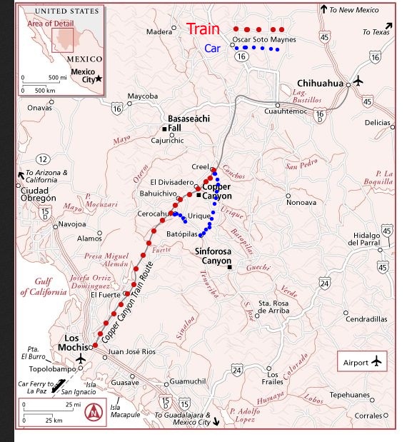
Copper canyon is a series of deep canyons similar to the Grand Canyon. The map below shows the location in Mexico and the Copper Canyon area in detail. We started the Mexican part of the trip after driving to the border, parking the car in a long term lot on the California side, walking to the border and then a taxi to the Tijuana Airport. We then flew to Los Mochis via Hermisillo. I have overlayed our trip on the map. We boarded the Chepe ( Chihuahua and Pacific) railroad in Los Mochis at 600 AM. We got off at Bahuichivo and were taken by van to Cerocahui. The next day we had a driver take us to Urique down a steep road. The following day we boarded the train again and got off at Creel. The next day we had another drive take us down another steep road to Batopilas. The mining town is at the bottom of a canyon. The next day we toured the town and the Sevato mission 5 km out of town. The next day we left Batopilas at 430 in the morning to avoid the road closure. Our last adventure was to go to Divisadero and ride the tram and hike. Finally, we returned to Los Mochis on the train and flew home via Hermosillo and Tijuana. We crossed the border on foot and got a van to the car lot. We stayed overnight in Los Mochis at both ends of our trip to catch the train on the way out and the plane on the way back. Notes
The map below show the Copper Canyon area in Northwest Mexico.