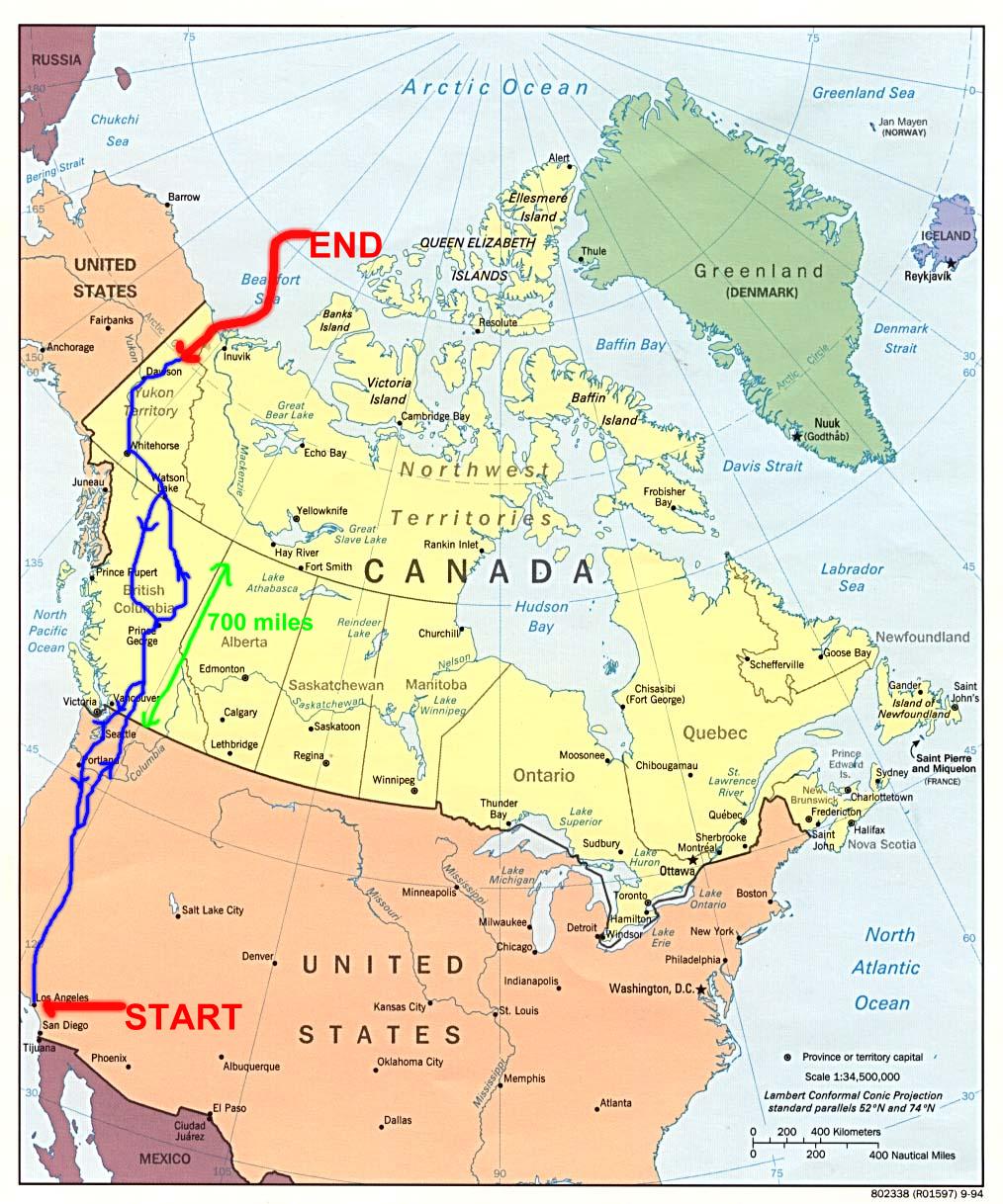
We drove up to the Canadian border, through British Columbia and into the Yukon with the arctic circle our ultimate destination. The 96 Chevrolet Lumina was the car and only had to have the fuel pump replaced in Dawson City in the Yukon. Before we went I had little appreciation of the vastness of western Canada. Below is a map of the US and the provinces of British Columbia (BC) and the Yukon. The Start and Destination are shown with the route in light blue. The arrows show the direction of the driving as we didn't return the same way we went up. We crossed the border at Osoyos then to Prince George, Watson Lake, Whitehorse, Dawson city, and then to the arctic circle. On the way back we left the Alaskan highway at Watson Lake to take the Cassiar highway back to Prince George and then to Anacortes in the US, crossing the border at Sumas. More detailed map are on the pages for each Province. The roads are very good in Canada and even the gravel road can be driven at 50 mph or more.Notes
Towns and Dates
8/5 Reno, NV
8/6 John Day, OR
8/7 Penticton, BC
8/8 Quesnel, BC
8/9 Fort St John, BC
8/10 Watson Lake, YK
8/11 Whitehorse, YK
8/12 Dawson City, YK
8/13 Dawson City, YK
8/14 Eagle Plains, YK
8/15 Moose Creek, YK
8/16 Carmack, YK
8/17 Alaska hwy 37 jct, YK
8/18 Shadow Mountain , BC
8/19 Stewart, BC
8/20 Burns Lake, BC
8/21 Quesnel, BC
8/22 Boston Bar, BC
8/23 Mt Baker campground, WA
8/24 Anacortes, WA
8/25 Vancouver, WA
8/26 Red Bluff, CA