Range and Basin National Monument Nevada
In October 2015 we took a trip to the new National Monument in central Nevada, 100 miles north of Las Vegas. It is wide open territory where the mountain ranges are aligned north and south with basins of 10 to 20 miles between the mountains. Hence the name Basin and Range. There have been cattle operations here for over 100 years, but the land is dry and there is little to eat for the cattle. A good description of the area is a birding site here. The weather was much cooler then we expected, with cool wind and rain two nights. We saw only 3 cars in our three days. Very few visitors in October 2015.
Roads
The roads shown are graded dirt roads. Some are very good and others have gullies across them. We entered on Seaman Wash Road and camped where the road came out of the hills. Regular cars, such as sedans ( I drove a 2010 Impala) are OK on the graded roads, but take care as rain storms can damage the roads. In Oct 2015, the Mail Summit Road was rough at points on the top of the pass due to water running across and along the road. There are a lot of small roads on the topo maps that are almost impassable even with a high clearance 4 wheel drive vehicle.
Maps
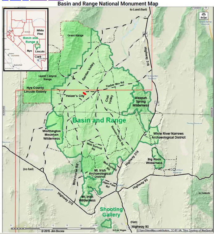
The map at the left shows the major roads as black and white dashed lines and minor roads as thinner dash and dot lines. Topo maps of the area are old but show most of the roads on the map at left. There are few signs and a GPS is a handy item to locate yourself when you come to an intersection. Outdoor maps, such as the DeLorme Nevada book. I use the Locus map app on my android tablet.
Camping locations
You can camp anywhere in the monument. The roads have high berms and level ground next to the roads is hard to find. We camped on a saddle and only one car came by in the three days. There is gas at Ash Springs, but no water in the monument. There are no other services near. Here are a few pictures of our camping site.
Heizer's City Art
This is the area of the monument which gets the most press coverage. At this time, Oct 2015, there is nothing to see except a locked gate. You can climb a low hill by the road to the gate and look at the structures, but they are two miles away. Skip this attraction.
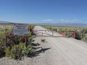
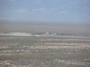
Locked gate Distant view of structures
Cattle operations and Water tanks
There are ongoing cattle grazing operations in the monument, but these are few and widely spread out.
There are water tanks spread throughout the valleys for cattle as well as wildlife. We saw a prong horn antelope drinking from one by our campsite. There are pictures here.
Abandoned cattle operation
This operation looked little it had been abandoned about 15 years ago. It is about 10 miles north of the Water Gap on the east side of the Golden Gate mountains at 38 08.7 N 115 18.8 W. Pictures can be seen here.
Roads and Scenary
Not many visitors. Roads are good and vistas are 20 to 30 miles with no human habitations. Pictures can be seen here.